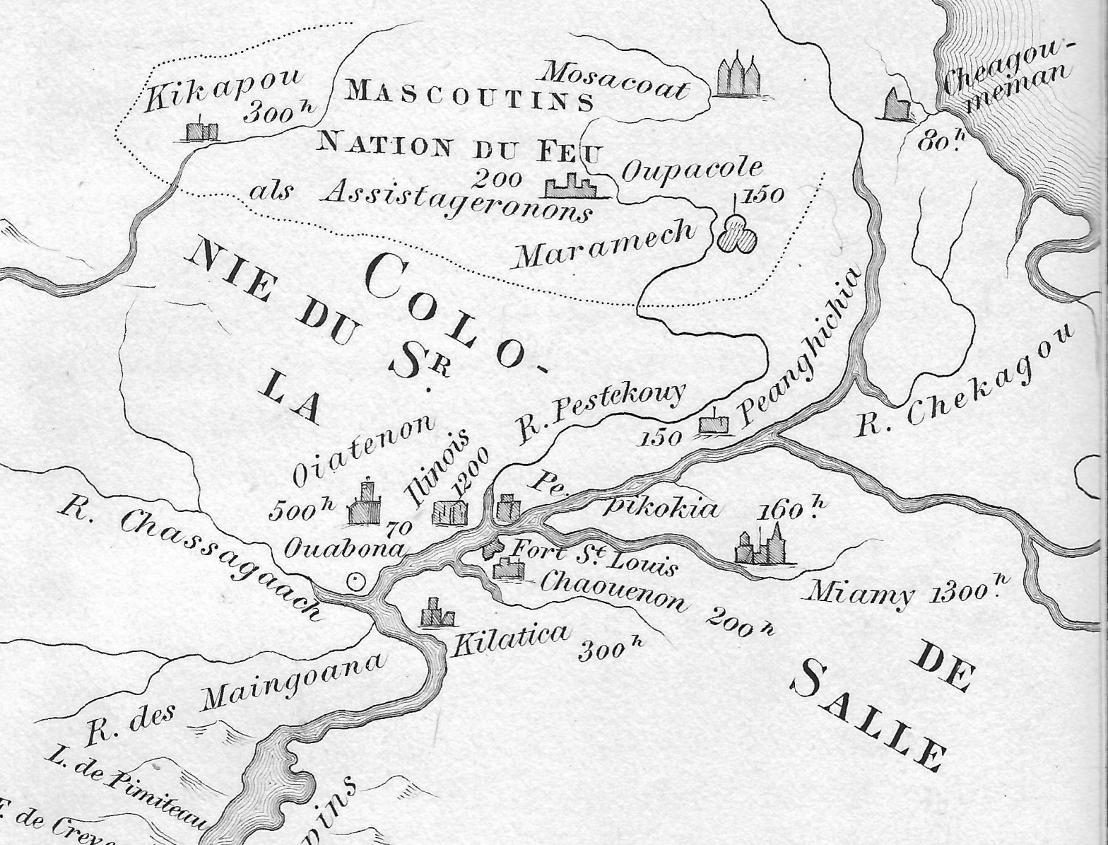
Amidst political intrigue on all fronts, Renè-Robert Cavalier, Sieur de La Salle and his able Lieutenant Henri de Tonty, spent the first months of the year 1683 building a fort deep in the woods of North America. They constructed Fort St. Louis upon a huge outcropping of rock overlooking the Illinois River, known today asContinue reading “Four Thousand Warriors”
Tag Archives: maps
Who Sold the New Purchase?
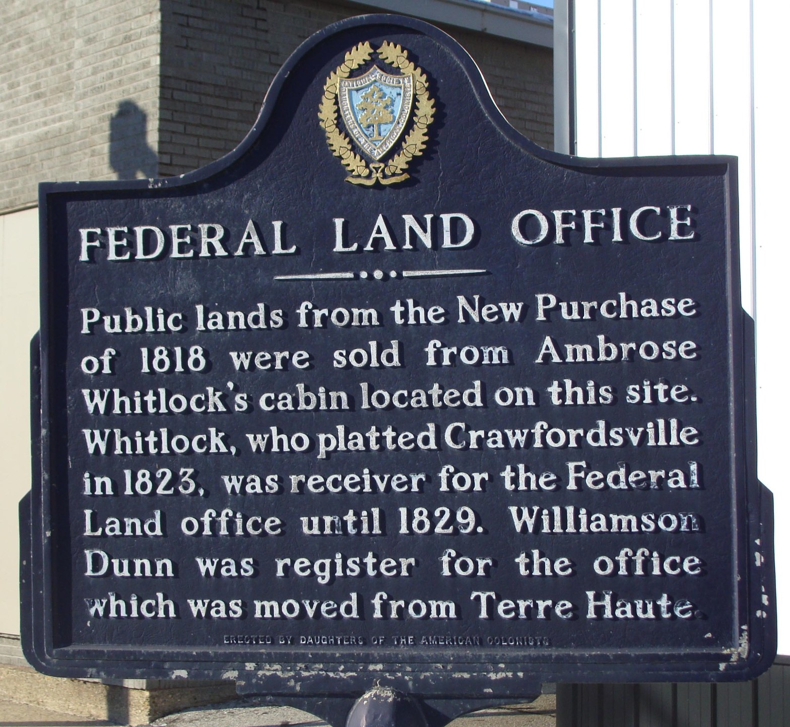
This is a reprint of an article originally published in the Fall 2015 edition of the Hoosier Surveyor, the quarterly magazine of the Indiana Society of Professional Land Surveyors. The magazine may be viewed by clicking this link: Hoosier Surveyor Volume 42-2. The full article is printed below. Who Sold the New Purchase? By JimContinue reading “Who Sold the New Purchase?”
