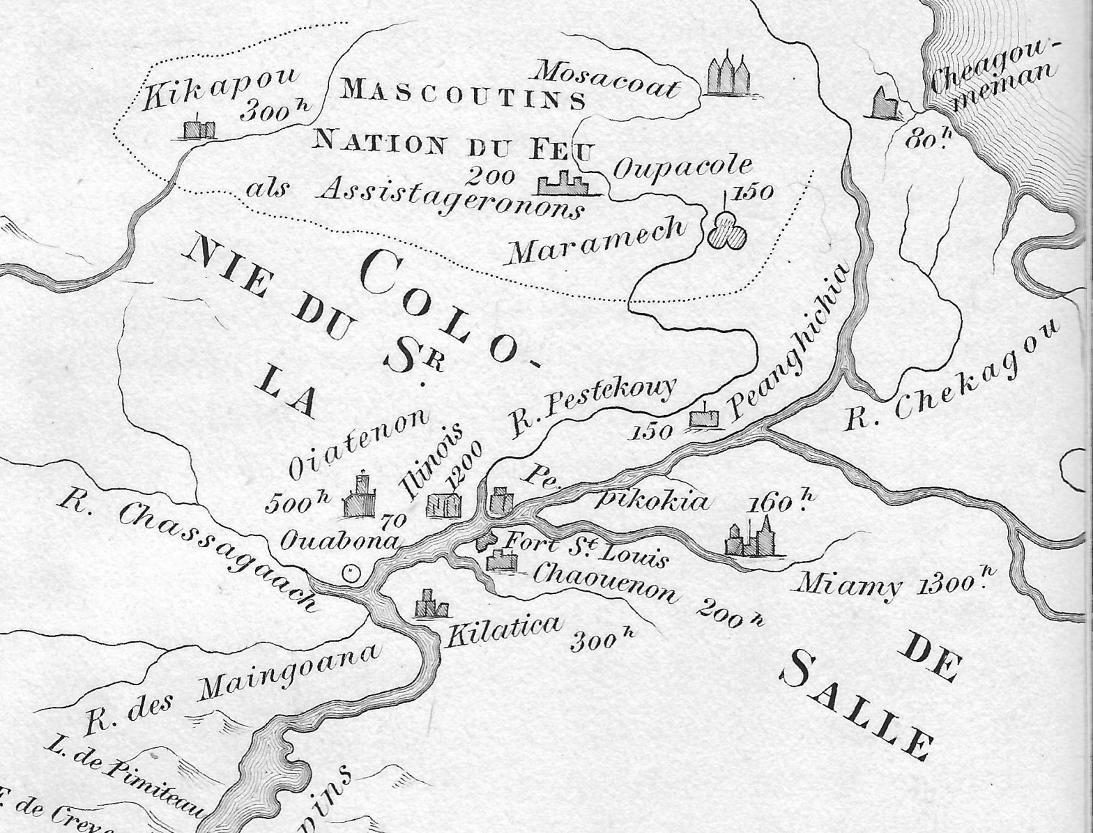
Amidst political intrigue on all fronts, Renè-Robert Cavalier, Sieur de La Salle and his able Lieutenant Henri de Tonty, spent the first months of the year 1683 building a fort deep in the woods of North America. They constructed Fort St. Louis upon a huge outcropping of rock overlooking the Illinois River, known today asContinue reading “Four Thousand Warriors”
Category Archives: French Maps
A Great Gathering of People…

A map… Behold the title block. Which says something along the lines of “MAP OF LOUISIANA OR OF THE VOYAGES OF SR. DE LA SALLE, and of the country which he discovered from New France to the Gulf of Mexico, the years 1679, 80, 81 & 82. By Jean Baptiste Louis Franquelin, the year 1684,Continue reading “A Great Gathering of People…”
Two French Maps and Several American Rivers

As the 17th century yielded to the 18th, France was a remarkable, powerful nation. King Louis XIV, the Sun King, had been on the throne for more than 50 years. Administrative power in France was centralized around the royal court, the once powerful Spain was coming under the influence of France, and the province ofContinue reading “Two French Maps and Several American Rivers”
