An atlas. Behold the title page:
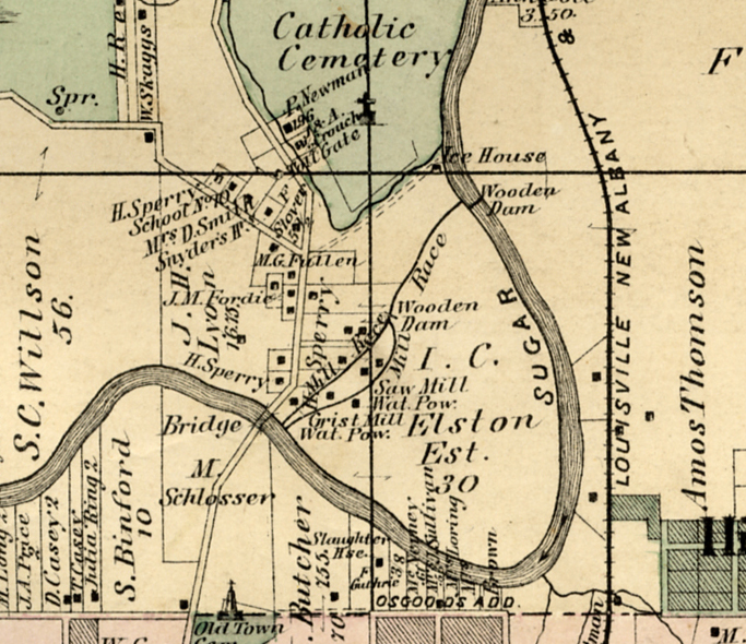
On page 29 of this 1878 atlas, we see the City of Crawfordsville, Indiana and some surrounding territory.
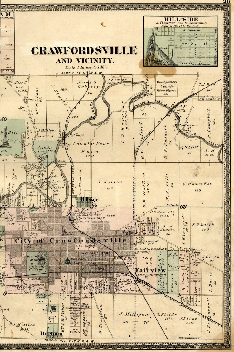
Check out the area just north of the growing community.
There is much of interest on the map. The County Poor Farm leaps off the page, along with the Pest House. A railroad is visible, and several cemeteries. The creek crosses the map prominently. Sugar Creek, the lifeblood of the community.
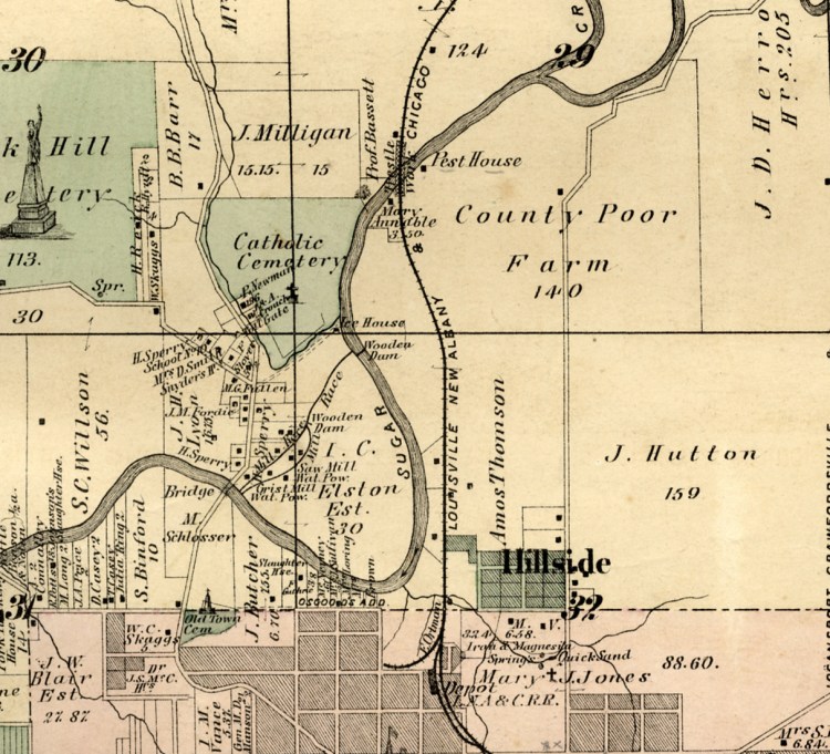
Let’s zoom in and look at the land within the significant bend in the creek.
Note the two wooden dams.
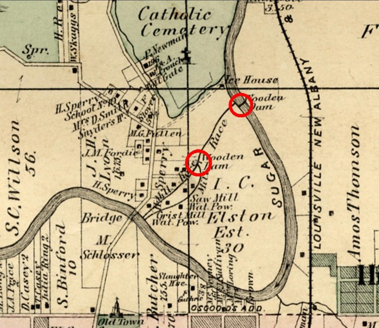
One dam diverts the creek into a Mill Race. The other dam splits the Mill Race into two channels.
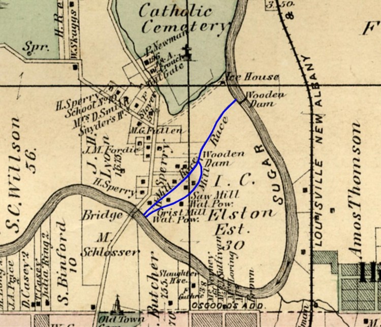
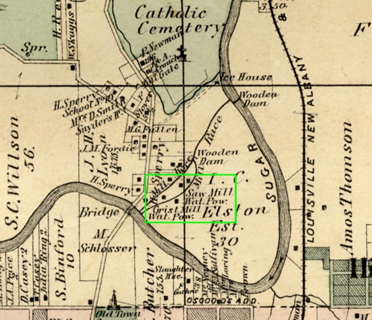
As might be expected, along the banks of the Mill Race, we find mills. The map demonstrates the presence of a saw mill and a grist mill, both powered by water.
Such industry. Dams diverting the creek into a race to power two mills. Who is behind this industry?
Ah, yes. The estate of I.C. Elston, which appears to own 30 acres of land being put to good use. I.C. Elston. That would be Issac Compton Elston, founder of Elston Bank, real estate developer and land speculator extraordinaire. The founder of Michigan City, Indiana and Kankakee, Illinois, Elston was a man about town when Crawfordsville was getting started as the regional land office. He knew how to make money. Indeed, he was so good at making money, he eventually became known as “The Richest Man in Indiana.” He is yet remembered in Crawfordsville as the namesake of the Elston Homestead, the official home of the President of Wabash College.
Among Elston’s many ventures, it appears that he built mills on the north side of Crawfordsville. At least this map indicates that the mills were situated on land owned by his estate. But Ike, as he was known, did not stop with mills. No! Not him. It appears he also constructed an ice house.
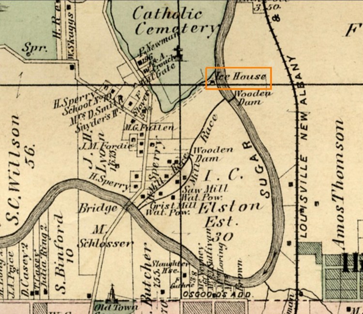
Situated just above the dam on Sugar Creek, is the Ice House. It makes sense that the ice house would be above the dam, where water would be sufficiently still to allow it to freeze. It also makes sense that the ice house would be near the saw mill, as saw dust is known to be an excellent material in which to pack ice. Ice packed in saw dust and tucked away in a properly insulated ice house can remain frozen for a very long time, ready to be sold when the weather gets hot.
What with the advent of modern refrigeration, we don’t use ice houses any more. At least not most of us. Some families in the Amish community use them, but the wider population does not. In 1878, though, they were quite important, a fact well understood by industrious, enterprising men like I.C. Elston.
Let’s take one last look at the map, zooming in on the dam and Ice House. Think for a moment about the human story which this small piece of this old map tells. Picture hardworking men out on the frozen section of the creek, scoring the ice, sawing out blocks of ice, transporting them to the ice house, packing them in saw dust to be stored until upcoming warm months. People working, making a living, contributing to the welfare of the community.

These old maps, they can really tell a story.
Base Image compliments of Wabash College. Images edited by Jim Swift.
